
A photograph looking south-east across Gloucester Street, taken from the Cambridge Terrace intersection. The road has been cordoned off ahead, and many excavators and cranes can be seen in the distance. A soldier is guarding the cordon.

South Island Operations Manager, Jeoff Barr, loading chemical toilets into a unimog in Christchurch. CPL Eddington is on the unimog helping. The chemical toilets were delivered to residents in Christchurch who had been without water for ten days.

A photograph looking south-east down High Street towards the intersection of Madras Street. A worker in a high-visibility vest and hard hat can be seen walking down the street. More can be seen in the distance.

South Island Operations Manager, Jeoff Barr, loading chemical toilets into a unimog in Christchurch. CPL Eddington is on the unimog helping. The chemical toilets were delivered to residents in Christchurch who had been without water for ten days.

A damaged building on the corner of Wilmer Street and Durham Street South. The outer wall of the property has crumbled, exposing the inside of the building. Wire fencing has been placed around the building as a cordon.

Components of the Durham Street Methodist Church's historic and valuable organ, which have been labelled and stacked inside the church. Workers from the South Island Organ Company have been deconstructing the organ so that it can be removed.

Photograph captioned by Fairfax, "Christchurch Earthquake. A massive 7.4 magnitude earthquake has hit Christchurch and the wider South Island, causing widespread damage, two serious injuries and power cuts to most of the city. Building damage in Kaiapoi".

A photograph looking south down Poplar Lane from the intersection of Lichfield Street. Bricks from earthquake-damaged buildings litter the lane. A car parked on the right side of the lane has been crushed by the falling bricks.

South Island Operations Manager, Jeoff Barr, loading chemical toilets into a unimog in Christchurch. CPL Eddington is on the unimog helping. The chemical toilets were delivered to residents in Christchurch who had been without water for ten days.

A photograph captioned by BeckerFraserPhotos, "The side door of the cathedral on the south face is as elegant as ever, even if the setting is not as well-kept as we are accustomed to seeing it".

A damaged building on the corner of Wilmer Street and Durham Street South. The outer wall of the property has crumbled, exposing the inside of the building. Wire fencing has been placed around the building as a cordon.

Photograph captioned by Fairfax, "Christchurch Earthquake. A massive 7.4 magnitude earthquake has hit Christchurch and the wider South Island, causing widespread damage, two serious injuries and power cuts to most of the city. Building damage in Kaiapoi".

Multicolour softcover book titled "The Big Quake, Canterbury September 4, 2010" by The Press; colour illustrations and maps; accompanying DVD. The extent of the damage caused by the 4 September 2010 earthquake is recorded in this book by Christchurch’s daily newspaper The Press. The overall message portrayed is one of community spirit and a com...

Multicolour softcover book titled "Quake, the Big Canterbury Earthquake of 2010" with colour photographs by David Wethey and text by Ian Stuart; published by Harper Collins Publishers (New Zealand) Limited, Auckland, 2010. ‘Quake: The Big Canterbury Earthquake of 2010’ contains aerial photographs of the damage to many major heritage sites in Ca...

A photograph looking south down Colombo Street towards the badly-damaged ChristChurch Cathedral. The bell tower has been partially demolished, and the rubble is visible in front. The Citizens' War Memorial can also be seen to the left.

A photograph of the rubble of the Observatory tower in the South Quad of the Christchurch Arts Centre. The tower collapsed during the 22 February 2011 earthquake. A digger was used to clear the rubble away from the building.

A photograph looking south down Colombo Street towards the earthquake-damaged ChristChurch Cathedral. A crane is sitting on the road in front of the Cathedral. In the background is a pile of rubble from the partially-demolished tower.

A photograph of the south side of High Street, taken from near the intersection of Manchester Street. The outer wall of the top storey of the Stranges Building has collapsed and the rubble has spilled onto the footpath below.

A photograph of Colombo Street looking south from the bridge near Moorhouse Avenue. Road cones have been placed across the road as well as wire fencing beyond. In the distance, a cordon can also be seen near Brougham Street.

When I was a kid this bit of land in the foreground was level and extended at least three times further out, but after the earthquakes you can see the angle that land near the river slumped. We used to catch a lot of herrings (yellow -eyed mullet) here when I was a kid, hence the local name of Herring Bay. Across the river is the Bexley Wetlands.

The cartoon is entitled 'seismic upheaval'. Prime Minister John Key and Finance Minister Bill English stand near great seismic cracks in the ground and stare sadly at a huge wallet, 'Bill's boodle', belonging to Bill English. Vast quantities of banknotes spill out of the cash pocket in the wallet which also contains a 'travel card', a 'house card' and an 'expenses card'. The various cards in the wallet refer to expense account embarrassments relating to Bill English. Etched in the ground are the words 'Christchurch quake' and 'South Canterbury Finance'. The cartoon refers to two major events in the Canterbury area in recent times that have incurred huge government costs; these are the collapse of the South Canterbury Finance Company and the earthquake that struck early Saturday morning 4th September. The South Canterbury Finance Company has been taken into receivership by the government which has guaranteed that all 30,000 fortunate high-risk investors will be paid out $1.6b thanks to the taxpayer. Treasury is assuming that the cost of the earthquake will reach $4 billion, including $2 billion worth of estimated damage to private dwellings and their contents, $1 billion of damage to commercial property, and $1 billion worth of damage to public infrastructure.
Quantity: 1 digital cartoon(s).

A temporary road sign indicates that the speed limit is 10 km/h along Rocking Horse Road in Southshore, due to the uneven surface of the road.

Photograph captioned by BeckerFraserPhotos, "Rear of the Department of Conservation building in Hereford Street seen from the intersection of Manchester and Worcester Streets".

A photograph looking south-west along Williams Street, from the Williams Street bridge, in Kaiapoi. In the distance is the rebuilt Blackwell's Department Store. The department store was rebuilt after the previous building was damaged in the 2010 and 2011 Canterbury earthquakes.
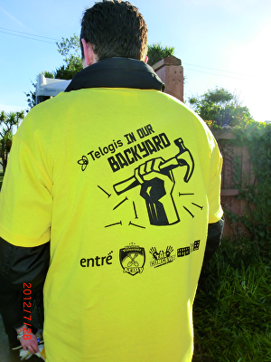
A photograph of a volunteer wearing an In Our Backyard competition shirt. The shirt lists supporters and sponsors of the competition.

One glass trophy presented to SCIRT IST to mark winning the Jurors Favourite Category in the 2014 Canstruction Christchurch competition.

None

These were scattered across the park.

Robbie watches a sand volcano smother his driveway.

South Island Operations Manager, Jeoff Barr, loading chemical toilets into a unimog in Christchurch. PTE Taylor and PTE Dennis on the unimog help. The chemical toilets were delivered to residents in Christchurch who had been without water for ten days.