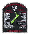
One black, red and white plastic-backed fabric uniform badge commemorating the 22 February 2011 earthquake; the words 'Christchurch 6.3 Quake' are embroidered in red along the top along with '22-2-2011' and '12.51pm'; Along the bottom are the words 'In Memory'; In the centre is a map of New Zealand in green with a red embroidered star over Cante...

A view after the 6.3 magnatude quake hit Christchurch 22 February 2011.
As time drifts by, more quickly now it seems!
Somewhere inside of me youth still lingers,
I’m still chasing dreams and butterflies
And gazing at rainbows in wonder!
For I believe youth never fades
In the eyes of those who can see
From the inside out!
From a poem by Annab...

A local inspecting the damage to St Lukes Church after the 6.3 quake hit.
For whom the bell tolls
Time marches on
For whom the bell tolls
Take a look to the sky just before you die
It's the last time you will
Blackened roar, massive roar, fills the crumbling sky
Shattered goal fills his soul with a ruthless cry
Stranger now are his eyes to this...

An aerial photograph of rural Canterbury following the 4 September earthquake.

A woman walks through liquefaction in Hendon Street in St Albans. The photographer comments, "Hendon St, St Albans, is very heavily silted".

A photograph of the clock drive from the Townsend Telescope. Many of the plates around the clock drive broke off during the 22 February 2011 earthquake.

Houses teeter over the edge above Redcliffs School.

20120131_8174_1D3-400 Eathquake damage
Houses above Main Road, Sumner.
#2153

Damaged houses above Shag Rock.

Part of a house that fell can be seen on the rocks above right hand containers.

The jetty in the South New Brighton Domain was rebuilt a few years ago. It was straight and level till the earthquakes. Has been closed for 2½ years now. The shags like it though!

Part of the container wall to stop rock falls on Main Road, Sumner.
The jetty in the South New Brighton Domain was rebuilt a few years ago. It was straight and level till the earthquakes. Has been closed for 2½ years now.

20130125_1749_1D3-400 Road Closed 1
The Lyttelton side of Evans Pass is closed (since the earthquake 23 months ago - 22/02/11). Prior to the road tunnel (through the Port Hills) opening in the early 1960s this was the main access road to the port of Lyttelton.
#3072

The sea wall at Beachville Road, Redcliffs, after the earthquake. It used to be straight and level - not now!
As a teenager I went fishing off this wall.

The cartoon shows the Christchurch Anglican Cathedral tower in ruins and without its steeple. Above the drawing is the date '22.2.11'. A second version shows a huge magnitude 6.3 earthquake tremor on a seismic graph on top of which is the date '22.2.11'. Context - On 22 February 2011 at 12:51 pm (NZDT), Christchurch experienced a major magnitude 6.3 earthquake, which resulted in severe damage and many casualties. A National State of Emergency has been declared. The cathedral tower has collapsed and there has been devastating damage to the remaining structure. The Cathedral is one of around six sites of extreme concern around the city where many are believed to still be trapped. This earthquake followed on from an original magnitude 7.1 earthquake on 4 September 2010 which did far less damage and in which no-one died.
Two versions of this cartoon are available
Quantity: 2 digital cartoon(s).

What more can one say except that Shag Rock is now about one third it's original height. Whitewash Head in the background with the road that now drops over a cliff.

20100913_3424_1D3-400 Castle Rock
The damage to Castle Rock, overlooking the Heathcote Valley from the 7.1 earthquake on September 4th.
#385

A photograph contributed by Erin Harrington, a participant in the Understanding Place research project.

A scan of page 63 of the third book of The Pledge.

A scan of page 63 of the fourth book of The Pledge.

A scan of page 63 of the seventh book of The Pledge.

A scan of page 63 of the sixth book of The Pledge.

Bronze award present to Matthew Prendergast and Thomas Nation, both from Christchurch. Pictured here with Vice-Chancellor Dr Rod Carr, Prime Minister John Key and Minister for Canterbury Earthquake Recovery Gerry Brownlee.

A scan of page 63 of the first book of The Pledge.

A scan of page 63 of the fifth book of The Pledge.

A photograph of tape artists with their creations - tape art bubbles for the mural. The photograph was taken at Street Talk, a Tape Art residency held from 6 - 9 March 2014. Street Talk was a collaborative project between All Right?, Healthy Christchurch and Tape Art NZ that had Christchurch communities create large tape art murals on the south wall of Community and Public Health.

A photograph of conference-goers producing a poster at the second annual Out of the Heart Pacific Women's Leadership Conference, held at Riccarton Racecourse on 21 May 2016. The conference was sponsored by All Right? and featured posters from the All Right? I am ... Identity project.

Barbeque at the Ohoka/Mandeville Showgrounds where mechanical Engineer students are having their lectures following the 2011 earthquake.

Damage to buildings on Victoria Street, near the Bealey Avenue intersection.