Search

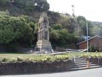
Digital Photograph: Earthquake Damage to Lyttelton Cenotaph on Simeon Quay…
Images, Canterbury Museum
One landscape colour digital photograph taken on 1 March 2011 showing earthquake damage to the Lyttelton Cenotaph on Simeon Quay. Designer The New Zealand Flag at the Lyttelton War Memorial, along with those around the country, flew at half mast for several days following the 22 February 2011 earthquakes. Following further aftershocks the Cenota...

Digital Photograph: Temporary Drinking Water Tank on Oxford Street, Lyttel…
Images, Canterbury Museum
One landscape colour digital photograph taken on 25 February 2011 showing the temporary water tank installed on the grassy [local name for Lyttelton Main School Field] to provide drinking water for residents to collect when there was no town supply water. A temporary source of drinking water was needed following the 22 February 2011 earthquake...

Digital Photograph: Earthquake damage to the Lyttelton Timeball Station.
Images, Canterbury Museum
One landscape colour digital photograph taken on 16 June 2011 showing the eastern skyline of Lyttelton without the tower of the Timeball Station and Signal Mast. Part of the ground floor remains visible. The Holcim Cement Silos and Lyttelton Port of Christchurch log storage yard are visible in the foreground. Photograph taken from Oxford Street...

Digital Photograph: Lyttelton Ambulance Station, north side of London Stre…
Images, Canterbury Museum
One landscape colour digital photograph taken on 19 November 2011 showing buildings on London Street. Visible in the photograph (left to right) are Lyttelton Ambulance Station and Bells Pharmacy - relocated into a converted house with law firm MacTodd on the upper floor. Discussions have been held between Lyttelton Police, St John Ambulance and...

Digital Photograph: North side of London Street, Lyttelton
Images, Canterbury Museum
One landscape colour digital photograph taken on 19 November 2011 showing part of the north side of London Street. The properties visible from left to right are Lyttel Piko Organic and Wholefoods, and Satchmo Café Pizzabar The Lyttelton streetscape has changed dramatically from its pre-earthquake appearance and will continue to change as new bu...

Digital Photograph: Temporary Bank of New Zealand Branch, north side of Lo…
Images, Canterbury Museum
One landscape colour digital photograph taken on 19 November 2011 showing the temporary premises of the Bank of New Zealand in a relocatable building on the footpath. The sign above the tellers window read "Lyttel Bank" The Lyttelton streetscape has changed dramatically from its pre-earthquake appearance and will continue to change as new build...
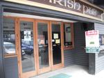
Digital Photograph: Irish Pub, south side of London Street, Lyttelton
Images, Canterbury Museum
One landscape colour digital photograph taken on 19 November 2011 showing earthquake repairs being undertaken to the Irish Pub on the south side of London Street. The Lyttelton streetscape has changed dramatically from its pre-earthquake appearance and will continue to change as new buildings are erected on empty sections. In this photograph Lo...

Digital Photograph: Temporary Artwork on the corner of London and Canterbu…
Images, Canterbury Museum
One landscape colour digital photograph taken on 19 November 2011 showing a temporary artwork on the site of the Albion Hotel/ Ground Delicatessen. After the demolition of the building the site was used for a Gap Filler initiative called the Lyttelton Petanque Club. The photograph shows a temporary artwork created from used bricks, probably from...

Digital Photograph: The Loons (Lyttelton Working Mens' Club), Canterbury S…
Images, Canterbury Museum
One landscape colour digital photograph taken on 19 November 2011 showing temporary propping of the Lyttelton Working Mens' Club/ The Loons. Built in 1909 the building has had a variety of uses including a garage and the Lyttelton Waterside Workers Social Club. More recently the Lyttelton Working Mens' Club has provided rehearsal and performanc...

Digital Photograph: Lyttelton Bakery, corner Norwich Quay and Canterbury S…
Images, Canterbury Museum
One landscape colour digital photograph taken on 19 November 2011 showing the temporary premises of Lyttelton Bakery in a relocatable building on Norwich Quay. The building is located on the site of the Royal Hotel. Also visible in the photograph are (left to right up Canterbury Street) Lyttelton Service Station, Samo, Lyttelton Telephone Exchan...

Digital Photograph: Posters in the Window of Leslie's Bookshop, London Str…
Images, Canterbury Museum
One landscape colour digital photograph taken on 19 November 2011 showing posters for the outdoor theatre production 'The Pirates of Corsair Bay' and the 2011 Lyttelton Summer Festival events scheduled for February and March 2011. The posters remained in the window of the red stickered building until it was demolished in early September 2012. A...

Digital Photograph: Elevated view of London Street, Lyttelton
Images, Canterbury Museum
One landscape colour digital photograph taken on 26 May 2013 of London Street, Lyttelton. The photograph was taken from St Davids Street looking west. The roofs of the portable buildings forming the temporary Lyttelton Police station are visible in the foreground. The Lyttelton Port Company offices and Tunnel Portal are prominent in the midgrou...
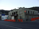
Digital Photograph: Mitre Hotel
Images, Canterbury Museum
One landscape colour digital photograph taken on 26 May 2013 on the corner of Norwich Quay and Canterbury Street, Lyttelton. The photograph shows the Mitre Hotel surrounded by temporary fencing. Three years after the 2010-2011 earthquakes there are still many uncertainties about which buildings can or will be retained. These buildings, or parts...

Digital Photograph: Vacant site on the corner of Canterbury and London Str…
Images, Canterbury Museum
One landscape colour digital photograph taken on 27 April 2011 showing the site occupied by the Volcano Restaurant, the Lava Bar, Lyttelton Fisheries and Coastal Living Design Store on London Street. The demolition of the Harbourlight Theatre is visible to the left of the photograph. The photograph is taken from Canterbury Street. The small siz...

Digital Photograph: Lyttelton looking north from the Oxford Street Overbri…
Images, Canterbury Museum
One landscape colour digital photograph taken on 11 May 2011 showing the town of Lyttelton looking north from the footpath of the Oxford Street Over bridge. The Lyttelton streetscape has changed dramatically from its pre-earthquake appearance and will continue to change as new buildings are erected on empty sections. In this photograph the dome...

Digital Photograph: Demolition of the Harbourlight Theatre on London Stree…
Images, Canterbury Museum
One landscape colour digital photograph taken on 27 April 2011 showing the demolition of the Harbourlight Theatre on London Street. In the background of the photo the damage to headstones in the Roman Catholic and Dissenters sections of the cemetery on Reserve Terrace can be seen. Architect In Christchurch's Central Business District many of the...

Digital Photograph: Earthquake damage to the London Street Restaurant on L…
Images, Canterbury Museum
One landscape colour digital photograph taken on 27 April 2011 showing damage to the London Street Restaurant. Photograph taken looking west from the intersection of London Street with Oxford Street and Sumner Road. Adaptability and quick thinking has become a key part of business survival in post earthquake Canterbury. The owner of this bui...

Digital Photograph: Demolition on the corner of Canterbury and London Stre…
Images, Canterbury Museum
One landscape colour digital photograph taken on 15 April 2011 showing the demolition of the Volcano Restaurant, the Lava Bar, Lyttelton Fisheries and Coastal Living Design Store on the corner of London and Canterbury Streets. In Christchurch's Central Business District many of the high profile demolitions took place out of public view in the ...

Digital Photograph: Lyttelton Main School from the Gaol Steps, Lyttelton
Images, Canterbury Museum
One landscape colour digital photograph taken on 13 May 2011 showing Lyttelton Main School viewed from above near the top of the Gaol Steps between Oxford and St Davids Streets. The photograph is taken at an angle. Several subsequently demolished buildings are visible beyond the school including (from left to right) Lyttelton Police Station, th...

Digital Photograph: Church of The Most Holy Trinity, Winchester Street, Ly…
Images, Canterbury Museum
One landscape colour digital photograph taken on 12 April 2011 showing earthquake damage to the Anglican Church of The Most Holy Trinity in Winchester Street Lyttelton. The photograph shows the bracing to the north transept which was erected after the 4 September 2010 earthquake. Architect After the 22 February 2011 earthquake the Church of the ...
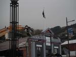
Digital Photograph: Demolition of Coastal Living, London Street, Lyttelton
Images, Canterbury Museum
One landscape colour digital photograph taken on 15 April 2011 showing the demolition of Coastal Living Design Store on London Street. In Christchurch's Central Business District many of the high profile demolitions took place out of public view in the Red Zone. By contrast, the demolitions on London Street after the 22 February 2011 earthquake...

Digital Photograph: Demolition on the Corner of Canterbury and London Stre…
Images, Canterbury Museum
One landscape colour digital photograph taken on 15 April 2011 showing the demolition of the Volcano Restaurant, the Lava Bar, Lyttelton Fisheries and Coastal Living Design Store on the corner of London and Canterbury Streets. Also visible is a placard advertising a Community Briefing to be held on 17 April 2011. In Christchurch's Central Bu...
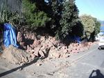
Digital Photograph: Earthquake Damage to Retaining Wall, corner of Oxford …
Images, Canterbury Museum
One landscape colour digital photograph taken on 15 June 2011 showing earthquake damage to the retaining wall on the northeast corner of Oxford and Exeter Streets. The wall was constructed from unreinforced blocks of local red volcanic rock held together with mortar. Retaining walls in Lyttelton were built of unreinforced soft volcanic stone in...

Digital Photograph: Earthquake damage to St John's Church, Winchester Stre…
Images, Canterbury Museum
One landscape colour digital photograph taken on 15 June 2011 showing earthquake damage to the Presbyterian Church of St John in Winchester Street, Lyttelton. Photograph shows the collapsed roof and tower. The photograph is taken from the southern side of the church. Architect The destructive force of the 14 June 2011 earthquakes on buildings in...

Digital Photograph: Demolition of former Library and Fire Station, corner …
Images, Canterbury Museum
One landscape colour digital photograph taken on 6 September 2011 showing the demolition of 2 Sumner Road, the former library and fire station. This building was a private residence at the time of its demolition. Photograph taken looking north on Oxford Street. Also visible in the photograph are the Lyttelton Information Centre, an entrance to ...

Digital Photograph: Earthquake damage to St John's Church, Winchester Stre…
Images, Canterbury Museum
One landscape colour digital photograph taken on 15 June 2011 showing earthquake damage to the Presbyterian Church of St John in Winchester Street, Lyttelton. Photograph shows the collapsed roof and tower. The photograph is taken from the southeast corner of the church. Architect St John's Lyttelton was one of the oldest Presbyterian Churches in...
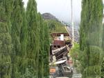
Digital Photograph: Earthquake damage to the old Vicarage, Lyttelton
Images, Canterbury Museum
One landscape colour digital photograph taken on 25 February 2011 showing the damage to the former Anglican Vicarage on Ripon Street Lyttelton. Taken from the footpath. Architect The sense of loss felt when confronted with the collapse or demolition of an historic building is compounded when that building is also a home. While the community sees...

Digital Photograph: Homemade sign on Fence
Images, Canterbury Museum
One landscape colour digital photograph taken on 28 April 2012 looking south from Cunningham Terrace, Lyttelton. The foreground of the photograph shows a blue temporary water supply pipe and markings spray painted on the footpath in preparation for repair work. The fence has a home made sign painted with the Fulton Hogan (FH) logo satirized to ...

Digital Photograph: Plume of Water from a Broken Water Main, Lyttelton
Images, Canterbury Museum
One landscape colour digital photograph taken on 28 February 2011 showing the plume of water from a broken water main. The plume appears to be in the vicinity of the Bridle Path. Photograph taken looking west from the corner of Canterbury and Ripon Streets. Repairing infrastructure following the Canterbury Earthquakes has proved to be a complex...

Digital Photograph: Victoria Street
Images, Canterbury Museum
One landscape colour digital photograph taken on 6 September 2010 showing earthquake damage to buildings on Victoria Street near Bealey Avenue. The red brick building is the Knox Church; it still stands on the corner of Bealey Avenue and Victoria Street following the earthquake, though some extreme measures were taken to make it safe. The red b...
