Christchurch CBD
New Zealand
31 August 2011

Christchurch CBD
New Zealand
31 August 2011

Christchurch Cathedral, Cathedral Square.

Christchurch Cathedral, Cathedral Square.

Photos taken in Lyttelton on March 20 following the February 22 earthquake.
File reference: CCL-2011-03-20-After-The-Earthquake-P1110714
From the collection of Christchurch City Libraries

Photos taken in Lyttelton on March 20 following the February 22 earthquake.
File reference: CCL-2011-03-20-After-The-Earthquake-P1110719
From the collection of Christchurch City Libraries

Absorbed in preschool storytime.
Photos taken in Diamond Harbour Library on May 24, 2011 following the February 22 earthquake.
File reference: CCL-2011-05-24-Diamond Harbour-After-The-Earthquake-IMG_21
From the collection of Christchurch City Libraries

Toppled statue of polar explorer Robert Falcon Scott, Worcester Street near Oxford Terrace.

The Iconic Bar, near the corner of Manchester Street and Gloucester Street.

813 Colombo Street looking south-ish, near the corner of Peterborough Street.

YHA Christchurch City Central, 273 Manchester Street, between Armagh Street and Gloucester Street.

Manchester Street looking north-ish, taken from the Gloucester Street intersection.

Montreal Street looking north, near the corner of Hereford Street, Christchurch.

A photograph of volunteers from the Wellington Emergency Management Office preparing for their journey to Christchurch after the 22 February 2011 earthquake.

A photograph of a temporary emergency management centre set up in a hall after the 22 February 2011 earthquake.

A photograph of volunteers working in a temporary emergency management centre set up after the 22 February 2011 earthquake.

A photograph of volunteers working in a temporary emergency management centre set up after the 22 February 2011 earthquake.

A photograph of the damaged Hotel Grand Chancellor on Cashel Street taken shortly after the 22 February 2011 earthquake.

One landscape colour digital photograph taken on 25 February 2011 showing damage to the Lodge of Unanimity No 3 at the intersection of St Davids Street and Sumner Road. Original BuildingAdditions The Lodge of Unanimity was established in Lyttelton in 1851. This building was designed in 1878 by Benjamin Woolfield Mountfort, who was a member of th...

Two pairs of size 11-13 red and black striped merino wool socks with a black seismograph marking above the ankle; held together by black, red and white branded card packaging. Produced following the 22 February 2011 earthquake. The Aftersocks fundraising campaign was an initiative to support the Canterbury region following the 22 February 2011 ...

Sign of the times across from the library.
Photos taken in Lyttelton Library on May 24, 2011 following the February 22 earthquake.
File reference: CCL-2011-05-24-Lyttelton-After-The-Earthquake-IMG_17
From the collection of Christchurch City Libraries

Lyttelton is a one dog library today.
Photos taken in Lyttelton Library on May 24, 2011 following the February 22 earthquake.
File reference: CCL-2011-05-24-Lyttelton-After-The-Earthquake-IMG_20
From the collection of Christchurch City Libraries

Propped up neighbours but life goes one.
Photos taken in Lyttelton Library on May 24, 2011 following the February 22 earthquake.
File reference: CCL-2011-05-24-Lyttelton-After-The-Earthquake-IMG_15
From the collection of Christchurch City Libraries

One landscape colour digital photograph taken on 15 June 2011 showing earthquake damage to the Anglican Church of The Most Holy Trinity in Winchester Street, Lyttelton. Photograph shows collapsed roof of the nave and north transept. Photograph taken from the north side of the church. Architect The collapse of the Church of the Most Holy Trinity ...

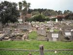
One landscape colour digital photograph taken on 30 June 2011 showing earthquake damage to graves in Lyttelton Roman Catholic and Dissenters (Public) Cemeteries in Reserve Terrace. Most of the headstones and grave surrounds in the photograph show damage. Looking east in the Dissenters (Public) section of the cemetery. The Lyttelton cemeteries a...

One landscape colour digital photograph taken on 30 June 2011 showing earthquake damage to a section of retaining wall in Sumner Road. Plastic sheeting installed to stabilise previous damage and protect from water erosion is visible to the right of the photograph. Also visible in the photograph is a boarded up broken window and temporary safety ...

One landscape colour digital photograph taken on 15 June 2011 showing earthquake damage to the Anglican Church of The Most Holy Trinity in Winchester Street, Lyttelton. Photograph shows collapsed roof of the nave and north transept. Photograph taken from the northwest corner of the church. Architect The collapse of the Church of the Most Holy Tr...

Photos taken in Lyttelton on April 15 showing the demolition of the Volcano Cafe, the Lava Bar, Lyttelton Fisheries and the coastal living design store following the February 22 earthquake.
File reference:
From the collection of Christchurch City Libraries

Photos taken in Lyttelton on April 15 showing the demolition of the Volcano Cafe, the Lava Bar, Lyttelton Fisheries and the coastal living design store following the February 22 earthquake.
File reference:
From the collection of Christchurch City Libraries

Photos taken in Lyttelton on April 15 showing the demolition of the Volcano Cafe, the Lava Bar, Lyttelton Fisheries and the coastal living design store following the February 22 earthquake.
File reference:
From the collection of Christchurch City Libraries
