
Two girls pass under a bridge as they paddle a kayak down the Avon river through Hagley park.

The footpath on Cambridge Terrace and areas bordering the Avon River have been badly damaged following the earthquakes.

The footpath on Cambridge Terrace and areas bordering the Avon River have been badly damaged following the earthquakes.

A photograph of the back of the Christchurch Town Hall, taken from across the river in Victoria Square.

A photograph of the back of the Christchurch Town Hall, taken from across the river in Victoria Square.

A photograph of the back of the Christchurch Town Hall, taken from across the river in Victoria Square.

A photograph of the Avon River, showing the high water level caused by the earthquake displacing the land.

A photograph of the back of the Christchurch Town Hall, taken from across the river in Victoria Square.

An aerial photograph of Canterbury and the Waimakariri River following the 4 September earthquake, taken from a helicopter.

Cracks in the river bank beside the Southern Region Coastguard Waimakariri-Ashley boathouse on Charles Street in Kaiapoi.

Roading machinery parked on the side of River Road. The road is under repair, but has not yet been resealed. The photographer comments, "Looking east to Banks Ave-Dallington Tce. River Rd nearly ready for re-sealing. Over the next year, the road subsided and was repaired 3 or 4 times".

Photograph captioned by BeckerFraserPhotos, "Anzac Drive close to the Avon River showing the liquefaction and ground tearing".

A view over the Avon River towards Pomeroy's Old Brewery Inn, which has fencing and road cones in front.

Photograph captioned by BeckerFraserPhotos, "The river is running very high near this stretch of New Brighton Road".

Sticky Fingers Restaurant & Bar, on the ground floor of the Clarendon Tower, seen from across from the Avon river.

A house near the Avon river which has suffered damage. The door and one window have been boarded up.

The center of the river has slumped and the two banks have moved about a meter closer together which caused this footbridge to be so twisted. There is a suggestion that this be left as a memorial to the earthquake.

One Month after the Christchurch Earthquake. The mangled remains of the pedestrian bridge over the river Avon
Twitter | Facebook | My ...
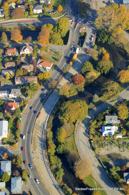
Photograph captioned by BeckerFraserPhotos, "The rebuild of Fitzgerald Avenue at the Avon Loop".

An aerial photograph of Durham Street with the Provincial Council Chambers in the centre.

Photograph captioned by BeckerFraserPhotos, "Loxley Avenue showing stop bank build".

An aerial photograph of Pegasus Bay near the mouth of the Waimakariri River. To the left, Brooklands can be seen as well as Kairaki in the distance.

An aerial photograph of Cambridge Terrace near Manchester Street. In the centre of the photograph is the site of the PGC Building, now a patch of grass.

The swollen Avon River running beside Boaters Restaurant in the Town Hall in the aftermath of the 22 February 2011 earthquake.

Damage to the pavement along the Williams Street bridge in Kaiapoi. Wire fencing with tape and road cones have been placed along the bridge to keep people away.

A photograph of a damaged pumping station on Avonside Drive.

A photograph of road works on Avonside Drive. A pipe is running along the road.

An aerial photograph looking over Porritt Park.

A view of the Worcester Street bridge from across the Avon River. In the background, the Our City O-Tautahi building is surrounded by scaffolding and bracing, the Rydges building behind.

A photograph of a bench on the banks of the Avon River. The water level is over the base of the bench.