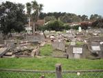
St Stephens Anglican Church, Shirley Road, Christchurch.
File reference: CCL-2012-05-10-Around-Shirley-May-2012 DSC_02858.JPG
From the collection of Christchurch City Libraries.

St Stephens Anglican Church, Shirley Road, Christchurch.
File reference: CCL-2012-05-10-Around-Shirley-May-2012 DSC_02859.JPG
From the collection of Christchurch City Libraries.

St Stephens Anglican Church, Shirley Road, Christchurch.
File reference: CCL-2012-05-10-Around-Shirley-May-2012 DSC_02856.JPG
From the collection of Christchurch City Libraries.

St Stephens Anglican Church, Shirley Road, Christchurch.
File reference: CCL-2012-05-10-Around-Shirley-May-2012 DSC_02860.JPG
From the collection of Christchurch City Libraries.

St Stephens Anglican Church, Shirley Road, Christchurch.
File reference: CCL-2012-05-10-Around-Shirley-May-2012 DSC_02855.JPG
From the collection of Christchurch City Libraries.

One Historic Places Trust report for Homebush Station. Homebush was in the process of being registered as a Historic Place, and this report was underway, when the homestead was severely damaged by the 4 September 2010 earthquake. Homebush Station was in the process of being registered as an historic place by the New Zealand Historic Places Trus...

One landscape colour digital photograph taken on 1 December 2010 showing a chimney, dislodged by the 4 September 2010 earthquake, atop a 1972 Toyota Crown car. The car to Andrie Woodroffe of 82 Hartley Avenue, Strowan. Car belonged to The chimney that crushed this car in Strowan, Christchurch was thrown from the roof of the house behind it, show...

One portrait colour digital photograph taken on 1 December 2010 showing a chimney, dislodged by the 4 September 2010 earthquake, atop a 1972 Toyota Crown car. The car to Andrie Woodroffe of 82 Hartley Avenue, Strowan. Car belonged to The chimney that crushed this car in Strowan, Christchurch was thrown from the roof of the house behind it, showi...

One landscape colour digital photograph taken on 25 February 2011 showing earthquake damage to the Lyttelton Timeball Station. Also visible is damage to some of the houses in the foreground such as temporarily patched holes in roofs where chimneys have fallen. Architect The Lyttelton Timeball Station was completed in 1876. Its function was to p...

North Hagley Park, Christchurch, New Zealand.
Tens of thousands turned out today to mark the one year anniversary of the devastating earthquake that struck the city at 12.51pm on 22 February, 2011.
185 people lost their lives.
file.stuff.co.nz/stuff/12-51/
Took 4 pa...

To be demolished very soon

None

An army truck in Avonside after the September 4th earthquake.

Photograph captioned by Fairfax, "Damage to Bridge Street, following Canterbury's earthquake".

Photograph captioned by Fairfax, "Liquefaction on playing fields following Canterbury's earthquake".

Photograph captioned by Fairfax, "Liquefaction on playing fields following Canterbury's earthquake".

Photograph captioned by Fairfax, "Canterbury earthquake. St Johns church in Hororata".

Photograph captioned by Fairfax, "Police check damaged building following Canterbury's earthquake".

One landscape colour digital photograph taken on 26 May 2013 showing the southern cliffs of Godley Head. Taken from the middle of the shipping channel. Some earthquake damage to the cliffs is visible. There were several major rock falls along the coastal cliffs near Christchurch and Lyttelton Harbour. At Godley Head these caused damage to the W...

One landscape colour digital photograph taken on 15 June 2011 showing earthquake damage to the Anglican Church of The Most Holy Trinity in Winchester Street, Lyttelton. Photograph shows collapsed roof of the nave and north transept. Photograph taken from the north side of the church. Architect The collapse of the Church of the Most Holy Trinity ...

One landscape colour digital photograph taken on 30 June 2011 showing earthquake damage to graves in Lyttelton Roman Catholic and Dissenters (Public) Cemeteries in Reserve Terrace. Most of the headstones and grave surrounds in the photograph show damage. Looking east in the Dissenters (Public) section of the cemetery. The Lyttelton cemeteries a...

One landscape colour digital photograph taken on 30 June 2011 showing earthquake damage to a section of retaining wall in Sumner Road. Plastic sheeting installed to stabilise previous damage and protect from water erosion is visible to the right of the photograph. Also visible in the photograph is a boarded up broken window and temporary safety ...

One landscape colour digital photograph taken on 15 June 2011 showing earthquake damage to the Anglican Church of The Most Holy Trinity in Winchester Street, Lyttelton. Photograph shows collapsed roof of the nave and north transept. Photograph taken from the northwest corner of the church. Architect The collapse of the Church of the Most Holy Tr...

The original City Librarian's house at Canterbury Public Library.
File reference: CCL-2011-08-12-CanterburyPublic Library pre-demolition-002
From the collection of Christchurch City Libraries.

None

None

None

Photos taken in Lyttelton following the February 22 earthquake.
Permit authorised by commanding officer HMNZS Canterbury.
File ref: CCL-2011-03-05-After-The-Earthquake-P1110452
From the collection of Christchurch City Libraries

One landscape colour digital photograph taken on 19 April 2011 showing the demolition of the Empire Hotel on London Street. The photograph shows the façade of the hotel supported by the framework installed to brace the building after the 4 September 2010 earthquake. A crane is being used to enable the east wall to be demolished by hand to avoid...

One trophy made from a can attached to a wooden base issued to SCIRT as a thank you for participating in Canstruction Christchurch. Features a custom printed label which celebrates teamwork in place of the usual nutritional information.
