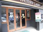
Shirley Community Centre, Shirley Road, Christchurch.
File reference: CCL-2012-05-10-Around-Shirley-May-2012 DSC_02866.JPG
From the collection of Christchurch City Libraries.

Shirley Community Centre, Shirley Road, Christchurch.
File reference: CCL-2012-05-10-Around-Shirley-May-2012 DSC_02862.JPG
From the collection of Christchurch City Libraries.

Shirley Community Centre, Shirley Road, Christchurch.
File reference: CCL-2012-05-10-Around-Shirley-May-2012 DSC_02869.JPG
From the collection of Christchurch City Libraries.

Shirley Community Centre, Shirley Road, Christchurch.
File reference: CCL-2012-05-10-Around-Shirley-May-2012 DSC_02863.JPG
From the collection of Christchurch City Libraries.

Shirley Community Centre, Shirley Road, Christchurch.
File reference: CCL-2012-05-10-Around-Shirley-May-2012 DSC_02867.JPG
From the collection of Christchurch City Libraries.

A man stares at an enormous roadsign reading 'Cleanup' that dwarfs a smaller one pointing to Canterbury. Refers to the damage resulting from the Christchurch earthquake of 4th September 2010.
Quantity: 1 digital cartoon(s).

The cartoon shows a large church and two other buildings swaying around on spiral earthquake strengthening seismic restraints. As they sway they ring 'doing, doing!' Refers to the intention to strengthen buildings after the Christchurch earthquake of 4th September and its numerous after shocks.
Quantity: 1 digital cartoon(s).

None

One landscape colour digital photograph taken on 19 November 2011 showing earthquake repairs being undertaken to the Irish Pub on the south side of London Street. The Lyttelton streetscape has changed dramatically from its pre-earthquake appearance and will continue to change as new buildings are erected on empty sections. In this photograph Lo...

One landscape colour digital photograph taken on 16 June 2011 showing the site of the Timeball Station after its collapse. Part of the ground floor remains visible. Photograph taken from Oxford Street Overbridge. Architect The 13 June 2011 earthquakes caused the collapse of the already damaged Lyttelton Timeball Station. After the 22 February ...

One carved wooden lintel that decorated a doorway at Hadleigh House. Features a cross on shield motif. Owner of Hadleigh House 1904-1921

Damage from the Christchurch 7.1 earthquake on 4th Sept 2010

Someone representing 'government', 'neighbours', 'firemen', 'friends' etc, all of which are printed on a her tshirt, reaches down with a 'helping hand' to 'Canterbury'. Refers to the Canterbury of 4th September 2010.
Quantity: 1 digital cartoon(s).

The latest (but temporary) tourist attraction in mid-Canterbury! This was the previously unknown faultline where the Saturday 4 September 2010 earthquake originated.

Photograph captioned by Fairfax, "Mayor Bob Parker following Canterbury's earthquake".

Photograph captioned by Fairfax, "Mayor Bob Parker following Canterbury's earthquake".

Photograph captioned by Fairfax, "Mayor Bob Parker following Canterbury's earthquake".

Photograph captioned by Fairfax, "Mayor Bob Parker following Canterbury's earthquake".

Photograph captioned by Fairfax, "Mayor Bob Parker following Canterbury's earthquake".

Photograph captioned by Fairfax, "Mayor Bob Parker following Canterbury's earthquake".

Photograph captioned by Fairfax, "Building being demolished following Canterbury's earthquakes".

Photograph captioned by Fairfax, "Mayor Bob Parker following Canterbury's earthquake".

Photograph captioned by Fairfax, "Mayor Bob Parker following Canterbury's earthquake".

Shipping containers against the cliff on the road to Sumner, Christchurch.
File reference: CCL-2012-05-12-Around-Sumner-May-2012 DSC_011.JPG
From the collection of Christchurch City Libraries.

Damaged house on the cliff on the road to Sumner, Christchurch.
File reference: CCL-2012-05-12-Around-Sumner-May-2012 DSC_019.JPG
From the collection of Christchurch City Libraries.

One silver medal awarded to SCIRT in October 2013 from the Institution of Civil Engineers in the United Kingdom in recognition of the excellent in civil engineering. Includes storage case and explanation sheet.

None

rubble from earthquake at Papanui Corner

Canterbury Public Library viewed from near the Bridge of Rememberance,

One landscape colour digital photograph taken on 25 February 2011 showing earthquake damage to the Lyttelton Timeball Station. Also visible is damage to some of the houses in the foreground such as temporarily patched holes in roofs where chimneys have fallen. Architect The Lyttelton Timeball Station was completed in 1876. Its function was to p...
