
A photograph of a room inside a flat on Poplar Street taken during the Residential Access Project. The project gave residents temporary access within the red-zone cordon in order to retrieve items from their homes. The building's outer wall has crumbled leaving the room exposed.

A photograph of a room inside a flat on Poplar Street taken during the Residential Access Project. The project gave residents temporary access within the red-zone cordon in order to retrieve items from their homes. The building's outer wall has crumbled leaving the room exposed.

A photograph of a room inside a flat on Poplar Street taken during the Residential Access Project. The project gave residents temporary access within the red-zone cordon in order to retrieve items from their homes. The building's outer wall has crumbled leaving the room exposed.

A photograph of Danica Nel and other workers standing in line with their authorization forms for the Residential Access Project. The project gave residents temporary access within the red-zone cordon in order to retrieve items from their homes after the 22 February 2011 earthquake.

Photograph captioned by BeckerFraserPhotos, "The view from the top of Alice in Videoland".

A red-stickered building on Canterbury Street in Lyttelton. The building's facade has been propped up with timber, steel and concrete block bracing, and one of its windows has been weather proofed with plywood. Wire fencing has been place around the building as a cordon.

Ngai Tahu elders performing a powhiri to welcome workers of the Stronger Christchurch Infrastructure Rebuild Team (SCIRT). Mayor Bob Parker is standing to the right. The ceremony was held in Burwood Park.

A photograph submitted by Philip Broderick Willis to the QuakeStories website. The description reads, "We took this photo over a year after the quake. It was in a red-stickered restaurant in Cashel Mall. You can see exactly what the people in this building were doing on Feb 22.".

Notices on the doors of The Cook Shop on the ground level of the Strategy building, Montreal Street. The sign on the left reads, "Danger, your house has a red placard, do not enter". The sign to the right indicates that the building is unsafe to enter.

Photograph captioned by Fairfax, "Members of the Red Cross civil defence response team and South Canterbury Police have been in Christchurch helping with the earthquake clean up. Having a look at a damaged bridge on River Road near Tai Tapu is Anna Sole".

St John's Presbyterian Church on Winchester Street in Lyttelton. The ground around the church is strewn with masonry that has fallen from the church's walls and collapsed tower. The building's front door has been red-stickered and a sign that reads "No entry" is stuck to it.

A damaged brick building on Centaurus Road with "Danger Keep Out" tape around the property. The brick walls have cracked and broken above two of the windows and a red sticker has been placed on the front window indicating that the building is unsafe to enter.

The word 'faith' has been formed by flowers on the cordon fence beside St John the Baptist Church on Latimer Square. The photographer comments, "If I remember correctly this has been on the fence surrounding the Christchurch earthquake red zone for quite a while and looks remarkably pristine".

A snapshot from GPS Boomerang's SmartBird flight over the Christchurch red zone on 23 December 2012, looking over Hereford Street with the Re:Start container mall visible in the bottom right, Oxford Terrace to the left. The buildings at the end of Cashel Street near Oxford Terrace have been demolished.

A sign outside the Chinwag Eathai restaurant on Victoria Street reads "To all our valued customers. We are sorry to inform you as of Tuesday 17th January 2012 our building has been red stickered. Don't worry we will be back at a new location!! Yet to be confirmed".

Photograph captioned by Fairfax, "Makana Chocolate Factory. From left pastry chef/chocolatier Mel Chen, Marlborough Red Cross vice president Edity McKay and Makana retail manager Heloise Shand. Edith accepted a cheque for $4,000 from Makana to go to the Christchurch earthquake fund".

A photograph of a room inside a flat on Poplar Street taken during the Residential Access Project. The project gave residents temporary access within the red-zone cordon in order to retrieve items from their homes. The building's outer wall has crumbled leaving the room exposed.

A photograph of workers from the Residential Access Project sitting outside the Alice in Videoland Building on the corner of Tuam and High Streets. The project gave residents temporary access within the red-zone cordon in order to retrieve items from their homes.

A photograph of a study area in a flat on Poplar Street taken during the Residential Access Project. The project gave residents temporary access within the red-zone cordon in order to retrieve items from their homes. Books and papers have been strewn across the ground.

A photograph of a room inside a flat on Poplar Street taken during the Residential Access Project. The project gave residents temporary access within the red-zone cordon in order to retrieve items from their homes. The building's outer wall has crumbled leaving the room exposed.

Christchurch Earthquake Aftermath
PWS-2010-09-09-DSC02063
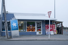
20120321_2397_1D3-47 Beachcomber Dairy
Corner of New Brighton Road and Rawson Street, New Brighton. This diary is inside the suburban red zone and will probably be demolished some time in the future. See how the earthquakes have moved the footpath - the post and phone box used to stand straight! This is one of the Teleccom Wi-Fi hotspot boo...

Low tide on the Avon River at New Brighton/Bexley. Note the original bank and the rock wall slipage on right. The white additions were added in March and April 2011 to protect the properties behind from flooding. Ultimately this area was "red zoned" with all houses removed or to be removed and the ground left till a rehabilitation method can ...

Photograph captioned by BeckerFraserPhotos, "A view of SOL Square from the top of the Alice in Videoland building on the corner of High Street and Tuam Street".

Photograph captioned by BeckerFraserPhotos, "City Council admin building (centre), Cathedral Square (lower left), Arts Centre (centre right) and public hospital (upper right)".

A photograph of an Urban Search and Rescue team member examining the contents of a flat on Poplar Street during the Residential Access Project. The project gave residents temporary access within the red-zone cordon in order to retrieve items from their homes. The buildings wall has crumbled leaving the room exposed.

A photograph of a desk and turn table taken during the Residential Access Project. The project gave residents temporary access within the red-zone cordon in order to retrieve items from their homes. The desk and turn table are covered in dust and rubble, and the outer wall is crumbled behind them.

A photograph of workers in fluorescent vests outside Alice in Videoland. The photograph was taken on 29 April 2011 during the Residential Access Project which gave residents temporary access within the red-zone cordon in order to retrieve items from their homes after the 22 February 2011 earthquake.

The fish and chip shop on Hills Road in Edgeware. The building is red stickered meaning it is unsafe to enter. Without the glass in the window, the inside of the store is easy to see. Panelling on the walls and roof have come down and much of the furniture has been removed.

Photograph captioned by Fairfax, "Manning Intermediate pupils (in white) performed a powhiri to welcome Halswell School pupils (in red) onto the school. Halswell School was badly damaged in the September 7.1 earthquake. Halswell School pupils with Principal Bruce Topham (right) listen to the welcome".