
A photograph captioned by BeckerFraserPhotos, "Wattle Drive in New Brighton. This part of the street is red zoned. This red zoned house is on the boundary between the zones".

Photograph captioned by BeckerFraserPhotos, "Looking south along Avondale Road to Breezes Road - classified as residential red zone on the right and residential green zone on the left".
Photograph captioned by BeckerFraserPhotos, "Avondale Avenue - this piece of the street is classified as residential red zone on the left and residential green zone on the right".

Photograph captioned by BeckerFraserPhotos, "Avondale Avenue - this piece of the street is classified as residential red zone on the left and residential green zone on the right".

A photograph of Julia Holden's painting 'Red Zone Home 1'.

A photograph of Julia Holden's painting 'Red Zone Home 2'.

A photograph of Julia Holden's painting 'Red Zone Home 1'.

A photograph of a postcard depicting Julia Holden's painting 'Red Zone Home 1'.

A map showing the location of green-zoned homes in the otherwise red-zoned Stour Drive.

A photograph of a postcard depicting Julia Holden's painting 'Red Zone Home 2'.

Photograph captioned by BeckerFraserPhotos, "Avonside (mostly red zone land)".

Photograph captioned by BeckerFraserPhotos, "Looking south along Kerrs Road which is zoned red in the foreground where it has slumped. Further along it's zoned green".

Photos taken in Parklands Library on March 31 following the February 22 earthquake.
File reference: CCL-2011-03-31-New Brighton-After-The-Earthquake-NB Parkland 014
From the collection of Christchurch City Libraries

one of Christchurch's abandoned suburbs. The land moved - bricks and block walls everywhere collapsed - two multi story buildings folded - 184 people died.
Wooden framed houses largely stayed up, many concrete slabs cracked, power poles leaned in liquid ground, surface bubbled, services ruptured .... damage to the cbd still gets the most cover...

A view after the 7.1 magnitude earthquake in Christchurch.
Community of the Sacred Name, cnr St Asaph and Barbadoes Streets

A slumped wooden boardwalk along New Brighton Road

Photograph captioned by BeckerFraserPhotos, "Red-zoned property 30 Seabreeze Close, Bexley".

Photograph captioned by BeckerFraserPhotos, "Red-zoned property in Seabreeze Close, Bexley".

Photograph captioned by BeckerFraserPhotos, "Red-zoned property in Seabreeze Close, Bexley".

Photograph captioned by BeckerFraserPhotos, "Red-zoned property in Seabreeze Close, Bexley".

20160415_0029_1D3-24 Red Zone Closures
The permanent closure (to motor vehicles) of the Bexley red zone streets has started.
This was once the main south-north route just west of the Avon River in the New Brighton area, till an expressway (ring road) was built about 80m to the west (right) about 12-13 years ago. Then it became just another ...

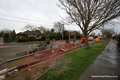
Photograph captioned by BeckerFraserPhotos, "CERA workers in the red zone".

Photograph captioned by BeckerFraserPhotos, "Red-zoned property at 26 Seabreeze Close, Bexley".

Photograph captioned by BeckerFraserPhotos, "150 Kerrs Road (in the residential red zone)".

Photograph captioned by BeckerFraserPhotos, "Waygreen Avenue in New Brighton, now red zoned land".

Photograph captioned by BeckerFraserPhotos, "148 Kerrs Road (in the residential red zone)".

Photograph captioned by BeckerFraserPhotos, "Red-zoned property at 8 Seabreeze Close, Bexley".

Photograph captioned by BeckerFraserPhotos, "A red-zoned property on Seabreeze Close in Bexley".

Photograph captioned by BeckerFraserPhotos, "Red-zoned property at 14 Seabreeze Close, Bexley".

Power has been removed at these properties on New Brighton Road.