
Scaffolding surrounds the Cathedral Junction building on Worcester Street. Security fences have been placed around the building to restrict access.

A demolition site on the corner of Manchester and Cashel Street. A truck is parked next to a pile of rubble behind a security fence. The damaged awnings of the stores to the left can be seen in the background.

An aerial photograph looking across Burwood to the Travis Wetlands and Bottle Lake Reserve.

Multiple cranes viewed through a cordon fence. The Novotel Hotel building stands in the foreground and the Rendezvous Hotel building in background.

The eastern face of Christ Church Cathedral. The damaged windows have been boarded up. A shipping container sits in the overgrown garden.

A member of the New Zealand Army stands outside a cordon check point on Hereford Street.

An aerial photograph of Horseshoe Lake, a residential area in Burwood.

An aerial photograph of Locksley Avenue in Dallington.

An aerial photograph of Kingsford Street and Viscount Place in the Horseshoe Lake area, Burwood.

An aerial photograph of Horseshoe Lake, a residential area in Burwood.

An aerial photograph of Tasman and Moncrieff Place in Horseshoe Lake, Dallington.

A new building under construction on Kilmore Street. A sign reading, 'Danger keep out' has been placed on the security fence.

An aerial photograph of a residential area in Bexley. In the distance, the New Brighton pier can be seen as well as the Rawhiti Domain and Bottle Lake Forrest.

A photograph captioned by BeckerFraserPhotos, "Digging out the basement of the ANZ building in Cathedral Square".

A photograph captioned by BeckerFraserPhotos, "The Heritage Apartment Hotel in Cathedral Square all refurbished and ready to occupy".

An aerial photograph of a residential area in Kaiapoi. The photograph has been captioned by BeckerFraserPhotos, "Many of the streets (but not all) in the area north of the Waimakariri River are red zoned".
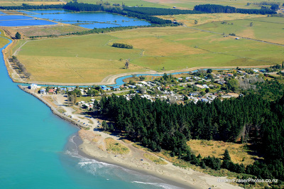
An aerial photograph of Kairaki over the Waimakariri River.

The demolition site of the Holiday Inn City Centre on Cashel Street. Reinforcement cabling protrudes from the top of the concrete posts. Rubble from the demolition surrounds the site.

A photograph captioned by BeckerFraserPhotos, "An artwork on the end wall of Re:START Mall".

A photograph of All Right? advertisements on the back of buses at the Red Bus depot on Ferry Road. The advertisements read, "When did you last really catch up?" and "When did you last show a little love?".

A photograph of All Right? advertisements on the back of a bus at the Red Bus depot on Ferry Road. The advertisement depicts two 'All Righties' catching up over coffee and reads, "When was your last mate date?".

The demolition site of the ANZ Building. A digger sits behind a pile of rubble, and water fills the former basement. The former post office can be seen in the background.

An aerial photograph of a residential area in Kaiapoi.

An aerial photograph of Avonside and its surrounding suburbs.

People look through viewing windows into the Red Zone at the east end of the Re:Start mall.

People look through viewing windows into the Red Zone at the east end of the Re:Start mall.

People look through viewing windows into the Red Zone at the east end of the Re:Start mall.

The intersection of Oxford Terrace and Worcester Street looking east.

The intersection of Oxford Terrace and Worcester Street looking north.

An aerial photograph of a residential area in Dallington.