
Search

Model: Wastewater Systems in an Earthquake
Images, Canterbury Museum
One interactive model which demonstrates how different types of pipes perform in an earthquake.

Book: The Butterfly and the Earthquake
Images, Canterbury Museum
One blue softcover children’s book titled 'The Butterfly and the Earthquake' with text by Carol McKeever and colour illustrations by Ned Barraud. Carol McKeever wrote this children’s book after the 22 February 2011 earthquake in Christchurch to help children cope with the traumatic experience of an earthquake. ‘The Butterfly and the Earthquake’...

Digital Photograph: Earthquake damage to Church of the Most Holy Trinity, …
Images, Canterbury Museum
One landscape colour digital photograph taken on 25 February 2011 showing earthquake damage to the Anglican Church of The Most Holy Trinity in Winchester Street Lyttelton. Photograph shows the bracing to the northern transept erected after the 4 September 2010 earthquake. Architect The earthquake damaged northern wall of the Anglican Church of t...

Digital Photograph: Earthquake Damage to Lyttelton Historical Museum on Gl…
Images, Canterbury Museum
One landscape colour digital photograph taken on 14 July 2011 showing damage to the Lyttelton Historical Museum on the corner of Gladstone Quay and Donald Street. The photograph shows the safety fencing and containers installed after the 22 February 2011 earthquakes. Architect Closed after the September 2010 earthquakes, the Lyttelton Museum bu...

Book: Trapped, Remarkable Stories of Survival from the 2011 Canterbury Ear…
Images, Canterbury Museum
One multi-coloured softcover book titled 'Trapped' by Martin van Beynen with colour illustrations and maps. Collected experiences of some of those trapped following the 22 February earthquake. Mainstream media coverage of the 22 February 2011 earthquake understandably focussed on the devastating damage and loss of life caused by the earthquake....

Digital Photograph: Earthquake Damage to Lyttelton Historical Museum on Gl…
Images, Canterbury Museum
One landscape colour digital photograph taken on 25 February 2011 showing damage to the Lyttelton Historical Museum on the corner of Gladstone Quay and Donald Street. The photograph shows bracing and safety fencing installed after the September 2010 earthquakes. Architect Closed after the September 2010 earthquakes, the Lyttelton Museum buildin...

Digital Photograph: Earthquake damage to St John's Church, Winchester Stre…
Images, Canterbury Museum
One landscape colour digital photograph taken on 15 June 2011 showing earthquake damage to the Presbyterian Church of St John in Winchester Street, Lyttelton. Photograph shows the collapsed roof and tower. The photograph is taken from the southern side of the church. Architect The destructive force of the 14 June 2011 earthquakes on buildings in...
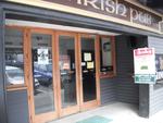
Digital Photograph: Irish Pub, south side of London Street, Lyttelton
Images, Canterbury Museum
One landscape colour digital photograph taken on 19 November 2011 showing earthquake repairs being undertaken to the Irish Pub on the south side of London Street. The Lyttelton streetscape has changed dramatically from its pre-earthquake appearance and will continue to change as new buildings are erected on empty sections. In this photograph Lo...
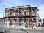
Digital Photograph: Earthquake damage to the Empire Hotel, London Street, …
Images, Canterbury Museum
One landscape colour digital photograph taken on 12 April 2011 showing earthquake damage to the Empire Hotel on London Street. The photograph shows the façade of the hotel supported by the framework installed to brace the building after the 4 September 2010 earthquake. Also visible on the fencing in the foreground is the advertising placard for...

Digital Photograph: Church of The Most Holy Trinity, Winchester Street, Ly…
Images, Canterbury Museum
One landscape colour digital photograph taken on 12 April 2011 showing earthquake damage to the Anglican Church of The Most Holy Trinity in Winchester Street Lyttelton. The photograph shows the bracing to the north transept which was erected after the 4 September 2010 earthquake. Architect After the 22 February 2011 earthquake the Church of the ...

Digital Photograph: Earthquake damage to the Lyttelton Timeball Station.
Images, Canterbury Museum
One landscape colour digital photograph taken on 16 June 2011 showing the site of the Timeball Station after its collapse. Part of the ground floor remains visible. Photograph taken from Oxford Street Overbridge. Architect The 13 June 2011 earthquakes caused the collapse of the already damaged Lyttelton Timeball Station. After the 22 February ...

Digital Photograph: Earthquake damage to searchlight emplacements, Godley …
Images, Canterbury Museum
One landscape colour digital photograph taken on 26 May 2013 showing the southern cliffs of Godley Head. Taken from the middle of the shipping channel. Some earthquake damage to the cliffs is visible. There were several major rock falls along the coastal cliffs near Christchurch and Lyttelton Harbour. At Godley Head these caused damage to the W...

Digital Photograph: Earthquake damage to Church of the Most Holy Trinity, …
Images, Canterbury Museum
One landscape colour digital photograph taken on 15 June 2011 showing earthquake damage to the Anglican Church of The Most Holy Trinity in Winchester Street, Lyttelton. Photograph shows collapsed roof of the nave and north transept. Photograph taken from the north side of the church. Architect The collapse of the Church of the Most Holy Trinity ...
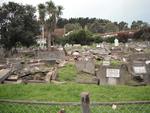
Digital Photograph: Earthquake Damage to Lyttelton Roman Catholic and Diss…
Images, Canterbury Museum
One landscape colour digital photograph taken on 30 June 2011 showing earthquake damage to graves in Lyttelton Roman Catholic and Dissenters (Public) Cemeteries in Reserve Terrace. Most of the headstones and grave surrounds in the photograph show damage. Looking east in the Dissenters (Public) section of the cemetery. The Lyttelton cemeteries a...

Digital Photograph: Earthquake damage to a retaining wall, Lyttelton
Images, Canterbury Museum
One landscape colour digital photograph taken on 30 June 2011 showing earthquake damage to a section of retaining wall in Sumner Road. Plastic sheeting installed to stabilise previous damage and protect from water erosion is visible to the right of the photograph. Also visible in the photograph is a boarded up broken window and temporary safety ...

Digital Photograph: Earthquake damage to Church of the Most Holy Trinity, …
Images, Canterbury Museum
One landscape colour digital photograph taken on 15 June 2011 showing earthquake damage to the Anglican Church of The Most Holy Trinity in Winchester Street, Lyttelton. Photograph shows collapsed roof of the nave and north transept. Photograph taken from the northwest corner of the church. Architect The collapse of the Church of the Most Holy Tr...

Digital Photograph: Earthquake damage to St Joseph's Church, Winchester St…
Images, Canterbury Museum
One portrait colour digital photograph taken on 25 February 2011 showing earthquake damage to the Catholic Church of St Joseph the Worker in Winchester Street Lyttelton. Photograph shows the main doors and roof at southern end of church. Nineteenth century stone buildings are particularly vulnerable to earthquake damage as the individual compon...

Book: The Christchurch Earthquake - The New Zealand Defence Force responds
Images, Canterbury Museum
A hardcover book that details in words and photographs the response of the New Zealand Army, Air Force and Navy to the 22 February 2011 earthquake.
High Viz Vest: SCIRT
Images, Canterbury Museum
One orange High Viz vest with a SCIRT logo on the front.

Right Front Car Door: Mazda CX7
Images, Canterbury Museum
One right front black Mazda CX7 car door damaged during the 22 February 2011 earthquake. This panel once belonged to a Mazda CX7 car that was crushed by falling rubble during the 22 February 2011 earthquake. Considerably bent out of shape, it demonstrates the potential danger from falling masonry during an earthquake. The spray painted markings...

Commemorative Badge: Australian Emergency Services, Christchurch Earthquak…
Images, Canterbury Museum
One red and black plastic-backed fabric uniform badge commemorating the Christchurch earthquake; badge has a red background with a black circular inset inside of which is a map of New Zealand in white with red concentric circles emanating from the Canterbury region. Across the top run the words 'Christchurch Earthquake 2011' and along the bottom...

Book: Quake, The Big Canterbury Earthquake of 2010
Images, Canterbury Museum
Multicolour softcover book titled "Quake, the Big Canterbury Earthquake of 2010" with colour photographs by David Wethey and text by Ian Stuart; published by Harper Collins Publishers (New Zealand) Limited, Auckland, 2010. ‘Quake: The Big Canterbury Earthquake of 2010’ contains aerial photographs of the damage to many major heritage sites in Ca...

Digital Photograph: Earthquake damage to St Joseph's Church, Winchester St…
Images, Canterbury Museum
One landscape colour digital photograph taken on 25 February 2011 showing earthquake damage to the Catholic Church of St Joseph the Worker in Winchester Street Lyttelton. Photograph shows the eastern side of the church. Photograph taken from St Davids Street. The earthquake damaged eastern wall of the Catholic Church of St Joseph the Worker sho...
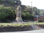
Digital Photograph: Earthquake Damage to Lyttelton Cenotaph on Simeon Quay…
Images, Canterbury Museum
One landscape colour digital photograph taken on 1 March 2011 showing earthquake damage to the Lyttelton Cenotaph on Simeon Quay. Designer The New Zealand Flag at the Lyttelton War Memorial, along with those around the country, flew at half mast for several days following the 22 February 2011 earthquakes. Following further aftershocks the Cenota...

Digital Photograph: Earthquake Damage to Dry Dock Pump House, Lyttelton
Images, Canterbury Museum
One portrait colour digital photograph taken on 1 March 2011 showing earthquake damage to the Dry Dock Pump House. Photograph taken from Dampiers Bay Pile Moorings showing the eastern end of the building and the Cassion. Engineer The brick pump house for the Lyttelton Graving or Dry Dock was damaged in the 22 February 2011 earthquake. Lyttelton...
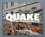
Book: Quake, the Big Canterbury Earthquake of 2010
Images, Canterbury Museum
One multi-coloured soft-cover book entitled 'Quake: the Big Canterbury Earthquake of 2010' with colour photographs by David Wethey and text by Ian Stuart. ‘Quake: The Big Canterbury Earthquake of 2010’ contains aerial photographs of the damage to many major heritage sites in Canterbury between Kaiapoi and Darfield after the 4 September 2010 ear...

Digital Photograph: Earthquake Damage to Lyttelton Times Building, Gladsto…
Images, Canterbury Museum
One landscape colour digital photograph taken on 3 March 2011 showing earthquake damage to the Lyttelton Times Building on Gladstone Quay. Also visible on the left of the photograph is the side of the adjoining British Hotel. Three years after the 2010-2011 earthquakes there are still many uncertainties about which buildings can or will be ret...

Book: My 26 Hours in a Concrete Coffin
Images, Canterbury Museum
Soft cover 57 page publication detailing the experience and rescue of Ann Bodkin from the Pyne Gould Corporation building following the 22 February 2011 earthquake. Account of her experiences of being trapped post 22 February 2011 earthquake.

Award: Canstruction Christchurch
Images, Canterbury Museum
One glass trophy presented to SCIRT IST to mark winning the Jurors Favourite Category in the 2014 Canstruction Christchurch competition.

